MENU

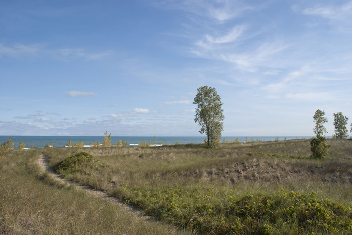
Lake Michigan, northerly winds, vegetation and sand interact to form the distinctive dune landscape. Inland from the beach, sand dunes rise in a series of ridges, blowouts, and valleys. Unique, intradunal ponds, called pannes, fill many depressions between the dune ridges.
The dunes represent a unique and highly specialized ecological system. Marquette Park is home to 73 threatened, endangered and rare species. Marquette Park hosts a wide-variety of habitat, making it a welcome home to many different species, including birds. Bird migration occurs along the eastern and western shores of Lake Michigan. Due to a “funnel effect” prevalent during the fall migration, the greatest concentration of migratory birds in Northwest Indiana occurs at Marquette Park at this time (Birds of Indiana, 1997). Several endangered, threatened and rare bird species frequent this site on an annual basis attracting wildlife enthusiasts from afar. In fact, the Audubon Society has designated Miller Beach, from Marquette Park to Lake Street, an Important Bird Area. Due to its unique location on the Great Lakes, Miller Beach has a peak fall season that brings migrating birds close enough to view and offers a type of birding called lake-watching that is especially popular.
Marquette Park’s dunes became a part of aviation history with Octave Chanute's 1890 glider and biplane flights. In the summer of 1896, seven years before the Wright brothers took off in their airplane, Octave Chanute's design of a biplane glider flew 350 feet in 14 seconds. This significant aviation accomplishment took place in the dunes in Marquette Park, along the southern shore of Lake Michigan.
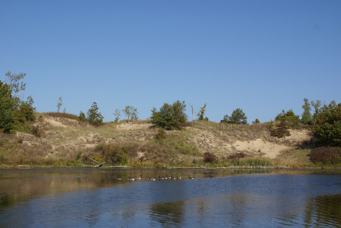
Historically the Marquette Park lagoons marked the location where the Grand Calumet River flowed into Lake Michigan. As industry in the area developed, the flow of the Grand Calumet was altered, and the lagoons are now a part of the headwaters of the east branch of the Grand Calumet River. The East Branch extends 12 river miles to the junction with the Indiana Harbor Canal. The river system is complex and driven primarily by lake level fluctuations in Lake Michigan and by the many discharges along the river that are associated with urban and industrial development.
As a result of this development, over time, sediment has accumulated within the lagoons, reducing the water depth and available fish habitat. Fortunately, over the past decade, the lagoons have been the subject of many restoration efforts. In 2001 Save the Dunes Conservation Fund organized the Grand Calumet River Lagoons Erosion Control Project at Marquette Park, repairing damage caused by erosion and sedimentation, improving public access to the lagoon, and restoring the natural landscape. The project raised funds and installed the fishing deck south of the Pavilion, providing users a launch point for non-motorized watercraft, including kayaks and canoes. In 2012, the City of Gary, in collaboration with the U.S. EPA, restored the east lagoon. Restoration efforts included dredging portions of the lagoon, the reconstruction of Patterson Island, some shoreline restoration, the creation of fish habitat, and the construction of an additional non-motorized watercraft launch and new fishing overlook.
Note: Fish Consumption Advisories may be in effect and certain fish should not be consumed without taking precautions. Additional information is available from the Indiana State Department of Health.
Marquette Park, located at the southernmost point of Lake Michigan, experiences the greatest sand movement within the region during storms. Sand movement occurs along the shoreline in both directions in longshore currents, although the predominant motion, or primary littoral drift, is from east to west. Sand movement also occurs offshore in the form of inner and outer sand bars.
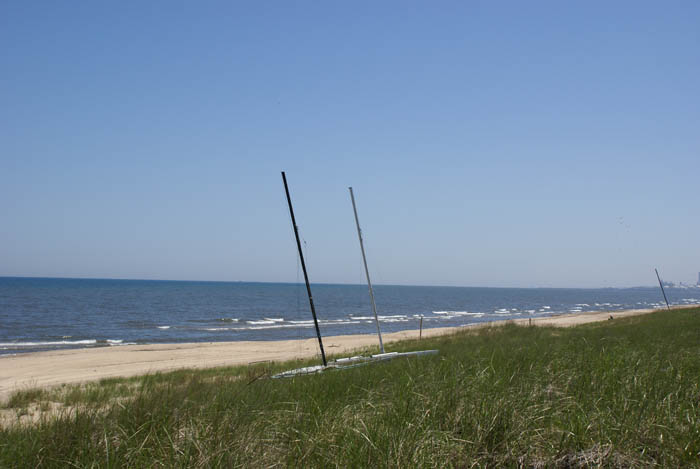
The U.S. Steel breakwater, located approximately one mile to the west of Lake Street Beach traps westward moving sand which causes it to accumulate. This trapped sand backs up from the breakwater all the way east to County Line Road. The sand accretion makes a visual impact on the landscape in the form of continually widening beaches and growing sand dunes.Marquette Park’s shoreline connects to the Indiana Dunes National Lakeshore at both its east and west ends.
Comprised of mostly black oaks, the oak savanna is a pre-settlement plant community that is at least two thousand years old. The oak woodlands serve as a gateway to the park, enhance biodiversity, and provide recreational opportunities. Paved and unpaved trails run throughout areas of Oak Savanna. In 2011 major restoration efforts took place within the oak savanna, including brush removal, canopy clearing, and eradication of invasive species.
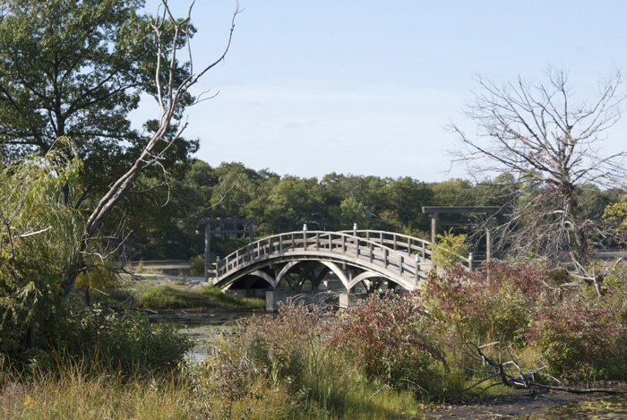
Two bridges connect to Patterson Island, both constructed in the 1930s: the Japanese bridge and the cable hung steel bridge. Over time, fluctuating lake levels and shoreline erosion have significantly impacted Patterson Island and the Japanese bridge and steel bridge connecting the Pavilion and the Picnic Pavilion fell into disrepair. As a part of the east lagoon restoration efforts, in 2012 the City of Gary reconstructed Patterson Island. Now, an accessible path connects the newly restored Japanese bridge and steel bridge, and a new fishing overlook has been constructed in place of the floating pier.